After my first trip to Europe, I rapidly settled on a particular style of travel: thorough research, lots of cities, lots of walking. Focusing more on neighborhoods than on tourist sites. And I haven’t really tried traveling in another way since.
For Christmas and New Years, Alex and I visited the UK. We kept up a very aggressive schedule, one that led me to rethink this method of travel a bit. I’ll discuss why in a bit… but this was the apotheosis of the style of travel I’m most familiar with.
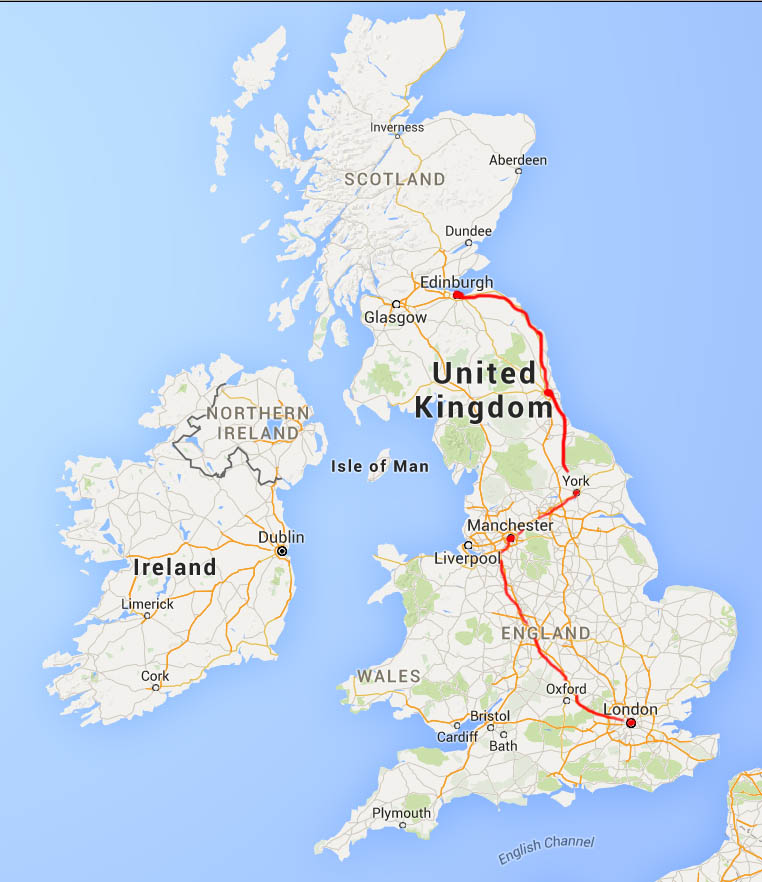
Our itinerary, from London to Edinburgh
How do I plan for these trips? These are methods that I first started using myself, but which scale really well to multiple people – so they’ve helped Alex and I coordinate quite a bit. It’s all in the tools. After deciding on a place to visit (ie, Britain), we create a shared Google Doc to put “must-see” sights or things that friends told us about. That involves looking at other people’s itineraries, local websites, and tour guides. For this trip to Britain, we had a lot of options – there’s so much history, and a diversity of both landscape and urban style. We can both edit simultaneously without worrying that someone will have an out of date itinerary. So it’s easy to throw together resources and clean them up later. For Britain, we considered the following destinations: London, Canterbury, Oxford, Cambridge, Wales, Manchester, York, Newcastle/Hadrian’s Wall, Edinburgh, St Andrew’s, Glasgow, and even Paris (via the Chunnel).
After choosing a set of destinations, next step is elimination. We had a bit over a week of vacation time available, and once we found cheap tickets, we knew there were three fixed destinations on our timeline: London, from which we arrived and departed, and Edinburgh, where we had plans for New Year’s Eve. We could fly from London to Edinburgh, spend a lot of time in London, maybe do a short trip to Paris. Or we could work our way up through the country and see stuff within England.
We opted for the latter, preferring to get a better picture of as much of Britain as possible, rather than see London, Edinburgh and Paris. Within England, we wanted to see a Premier League soccer game, and among the various options, the one that aligned best with our schedule was in Manchester. I’d heard about York as a really cool medieval city with alleyways and twists and turns, and city walls, and we were interested in the far north as well, near Hadrian’s Wall and Durham.
Having selected destinations, we next figure out where to go within each city. The key tool for that is Google’s My Maps. It’s basically Google Maps, but you can save any location that interests you, view it on your phone, etc. I create a new map, find the city (eg, London), and then drop pins in all the sights in our document: museums, parks, squares, cathedrals, etc. I use wikivoyage for basic research. This map is invaluable, because it does a good job clarifying where in the city is most interesting – and thus, where we should find lodging. Here’s our map of London. This map is also handy to track restaurant recommendations from friends, as well.
Locations decided and hotels booked, the only step remaining is to arrange travel between cities. All this goes into the doc, including addresses, phone numbers, and times. I print a copy of this doc for each of us, in case we don’t have internet access or phone batteries die. Be prepared!
I like this planning process, (it sounds like it’s a lot of work, but in reality within half an hour of lazy research you can have a quick picture of a city). If you know about better tools for this sort of thing, I’d love to hear about them.
What I’ve found, and which I felt was a problem even prior to visiting Britain, was that it’s too easy to research. For instance, it’s easy to look at Google street view and get 1/4 of the impact of being somewhere. Or you can watch endless travel videos on YouTube, mostly with shaky cameras. Hundreds of photos are available on Instagram or Flickr with a simple search. All these seem to dilute the impact of the place when you actually arrive. I’ve cut back on this type of research, preferring to see something with fresh eyes rather than be even more prepared.
My new policy, which I instituted for London, and fully committed to for our next trip to Istanbul, is not to see any visual depictions of the place if I can avoid them. Wikivoyage doesn’t have a lot of photos, so that’s good, and I prefer guide books that don’t have glossy photos (I’d rather have more details anyway). Instead of watching YouTube videos, I’ll read a book set in the location or about the history or culture. That enhances understanding, without diluting the experience.
Arriving in London
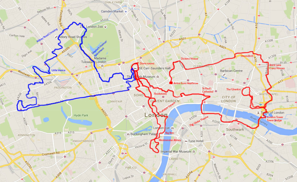
Rambles in London. First day in red, second day in blue.
We flew into Heathrow and took the tube into London. That in itself defied expectations. NYC subway cars are broad, tall, with a layer of filth, and there’s lots of standing room. London tube cars were cozy. Two rows of facing upholstered chairs, with low ceilings. It felt like traveling in a hobbit hole… I didn’t want to jump to conclusions, but it reaffirmed things I’d previously heard about the British preferring snug little accomodations. The tube stations were different than NYC as well: deeper, with a warren of tunnels. When we stepped out, we found ourselves in central London (Holborn Station), early on the morning of Christmas Eve. It was cool, but not chilly, with a misty rain. We wandered, getting our bearings. Our eventual destination was Shoreditch, the trendy ‘Brooklyn’ of London. (Comparing the trendy/revitalized downtown areas of foreign cities to Brooklyn irks me, but I guess it’s a useful shorthand for “trendy, rapidly gentrifying, hipster neighborhood”).

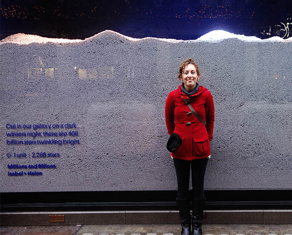
More Shoreditch street art, under a bridge.
On our way, we ended up walking past Charles Dickens’ house (now a museum, but just one of a great many identical little rowhouses on a broad street).
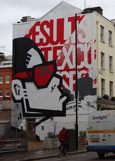
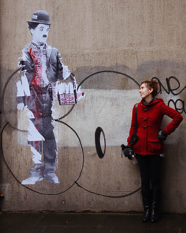
Street art
Shoreditch, which is a fun word to say, is the platonic ideal of the gentrified UK industrial zone. Apparently it’s even become a verb: ‘shoreditchify’. Regardless, it’s a nice area. Lots of cool street art, restaurants, but still with very old Georgian overtones. It felt old and new alike. Even better, it’s right near Brick Lane, a street completely full of Indian restaurants (also Pakistani, Sri Lankan, Bengali cuisine). We had some curry there. I really enjoyed it. Having worked at an Indian restaurant, and eaten a lot of Indian food in the US, I know the basics of Indian food… and there was a lot more variety here.
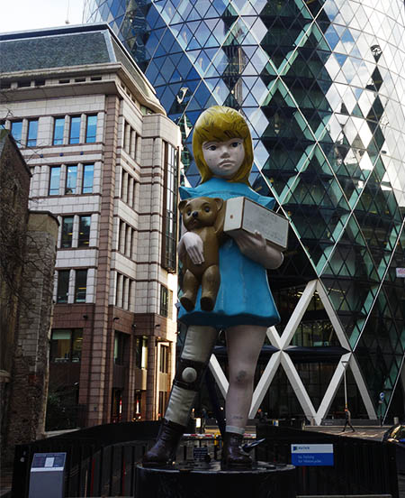
Damien Hirst statue outside the Gherkin
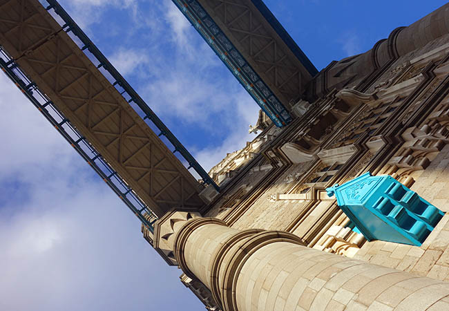
From there, we arced South, towards The City and Whitechapel. The City is the business/financial district, most known for the ‘Gherkin‘, as well as London Tower and Tower Bridge. Somehow, I’d conflated London Bridge, which has a recognizable name, with Tower Bridge, which has a recognizable appearance. We crossed to the south side of the Thames on Tower Bridge, which is really as beautiful as the photos lead you to believe.
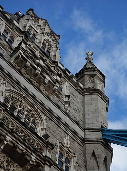
Tower Bridge
From there we continued along the Thames, taking in the views of London tower, before crossing back to check out St Paul’s Cathedral (closed without tickets), and eventually making our way to the London School of Economics. Why visit there? During holidays they rent out the dorms, so we had a cheap stay in downtown London. It felt like being back in college, down to the complimentary cafeteria breakfast.
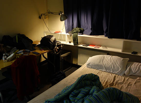
Our dorm room
After dropping off our backpacks, we went back out to find food. This was a tremendous challenge. Unlike in the US, things really shut down for three days during Christmas in the UK. Most supermarkets were closed, nearly all restaurants as well. We stopped in the local Chinatown and found some snacks, and found the restaurants opn – but with a Christmas ‘special:’ pricey prix fixe. We passed on that.
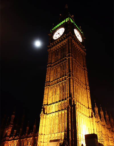
We also went through Leicester Square, which had a cute Christmas festival going on (ferris wheel, booths, etc), and walked past Big Ben and Westminster Abbey. Both really cool. One of my preconceptions about London was that all the big sights were both close together and awkwardly positioned around the Thames, like a tacky amusement park. But the reality didn’t bear that out. In fact, the layout of the city is pretty graceful.
Having arrived early, seen the sights over the course of a long day, and now that it was past dark, we returned to our dorm room, keeping an eye open for any pub or restaurant at all. And we had a stroke of good luck: there was a bar two blocks from the dorm. Even better: they had amazing mulled wine, and gave out little party poppers to celebrate the holiday. So our dinner was wine, beer, and potato chips (“crisps”). Regardless it felt cozy: the quiet dark city around us, cold weather pressing in on the windows, warm mulled wine in our hands and friendly people around us. Christmas Eve in London.


