Category Archives: Periodic Update

Sequoia National Park


The biggest living thing on earth, with crowd for comparison.

9/1/2013-9/2/2013

Sequoia National Park, adjacent to King’s Canyon, has a lot more than sequoias; in fact, the Sierra Nevadas turn out to be more awe-inspiring than the trees.


View of the Sierras from near Muir Grove

Sequioa is a short trip from Cedar Grove in King’s Canyon. It’s a strange park – all the roads are on the west side and the bulk of the park is only accessible by overnight backpacking. There’s a lot going on, actually: mountains, sequoias and even caves. On the first day I grabbed a campsite – very tough on labor day weekend and I got one of the last two available. Good timing!


Past the Muir Grove, this isolated open area had a great view.

From the campground, the John Muir grove of sequoias was accessible two miles away. A simple hike, the grove is very impressive. These trees aren’t much smaller than the famous ones the crowds adore, but I had them to myself. Pushing past the grove I had a beautiful view of the Sierra Nevada range. I read for a while on the rocks nearby and then returned to the campground.


Some of the pines have these huge cones; the cones for sequoias are surprisingly much smaller.

Later I wanted to go on another hike directly from the campground, but it was impossible to find the trail. Instead I took the shuttle bus to the General Sherman tree – the biggest living thing on earth. Like many of these large trees, it’s tough to get a feel for the size, especially since the tree is protected by a fence.


The trail to Moro Rock

There was another short (3 mile), unoccupied trail by which I returned to the visitor center. Waiting for the bus back I talked to an intern who was measuring how many people used the bus on the busy weekends (quite a few). And the bus – one of the last trips of the day – was filled with Jamaicans who were on an exchange program, working for the park.


I’m in a tree.

The next morning I hit some of the major attractions early, before they got crowded. I drove my car through a tree trunk – a rare honor! And I hiked the stairs up to Moro Rock, which had the very best view I’ve seen so far – hampered though it was by some fog and the low sun. This rock promontory stands far out in the middle of nowhere. The twisted stairs and slants up to the summits were pretty stomach-turning for those with an aversion to heights, but it was worth it to me.


‘Curtains’ in Crystal Caverns

I also visited one of the many caves in the park (but the only one open to the public). This ‘crystal cavern’ is the first ‘normal’ cave I’ve visited on the trip, with the usual calcium carbonate stalactites, columns, ribbons, and so forth. It had some of the best formations I’ve seen anywhere. I volunteered and was able to be the last person in line, so I was able to turn around a lot and look at the empty cave behind me, which is a special treat.

King’s Canyon National Park


One tiny section of King’s Canyon

8/29/2013-8/31/2013

Kings Canyon and Sequoia National Park lie east of San Francisco, in the Sierra Nevada mountains. These are an interesting combination – they’re jointly administered but remain separate parks. Kings Canyon actually has a small disjoint section to the west, next to Sequoia, that acts as a gateway to both parks, and which features only sequoias, while the main park is 30 miles to the east. Both parks are nestled inside a national forest, show the beauty of the Sierra Nevada, and prominently feature sequoias. It doesn’t make much sense to me. I knew little about King’s Canyon before I visited; apparently Muir called it a “second Yosemite,” which is strong praise!


General Grant tree: by presidential edict, the nation’s Christmas tree.

After passing through the entrance, I stopped to visit the General Grant tree. This is the 3rd largest living thing in the world; the trunk is 40 feet wide and it’s 280 feet tall.

Sequoias are a strange tree. They’re enormous – as big as a really big tree – and the larger among them have really peculiar bark. They really look like paper mache or something. The top of the trees is also misshapen, so they have none of the elegant beauty of redwoods. The same compound that allows redwoods to grow so large is present in sequoias: tannin, which limits damage from fire and insects.

After checking out the sequoias, I drove the 30 miles to the canyon itself. Along the way I stopped at one overlook and took a few pictures, not impressed. It looked like every forested valley, ever. But then the road turned a corner and I saw the true canyon itself. I was gobsmacked. It’s a huge canyon – measuring over 8,000 feet deep in most places – and composed mostly of exposed granite and sparse conifers.

I proceeded to the only accessible section of the canyon, Cedar Grove, at the very floor and next to the river which carved the canyon. It has a few campgrounds, a small lodge, a ranger station and a general store. An important bridge over the river was closed making travel between sections of this area circuitous.


The summit of the Lewis Creek trail.

After grabbing a camping site and talking to a ranger, I went on a hike. This was on the Lewis Creek trail; many of the trails are similar. The problem is that the walls of the canyon are quite steep before opening out into a somewhat broader highland meadow, so they are all strenuous to begin with. But, the views are just spectacular.


View of just a small section of King’s Canyon.

The next day I’d decided to do an overnight hike, and settled on Copper Creek. This was ambitious for a variety of reasons: it was an 11-mile trail, which gained a vertical mile and finished at 10,500 feet. And I would be carrying 20 pounds more than I was used to, with an overnight pack and gear rather than my daypack. I knew I was in trouble almost from the start – pretty quickly my legs felt like jelly and I was gasping for breath.


Ad hoc tent support…

I made it 5-6 miles and about 2500 feet up, and had to set up camp. Unfortunately, I discovered that my purification tablets were for *already* potable water and so useless with the mountain streams; my fiberglass tent pole snapped as well. So I was considering turning back – I knew the downhill trek would be fast.

But a Czech couple arrived and I was able to get some iodine tablets from them, and then improvised a support for my tent, so I stayed the night. The campsite grew quite crowded with at least 4 groups there, some noisily arriving at 8 pm, after dark and with everyone else in their tent.


Early morning view from the Copper Creek trail, I believe with aldens in the foreground.

I awoke very early, packed, and headed out. On the easy downhill jaunt back, I was treated to some great early morning views of the canyon. The air was cool and I was looking forward to the treat I’d promised myself the next day: an ice cream sandwich and Mountain Dew.


More of King’s Canyon

Driving back along the canyon road, I passed a few ranger SUVs and an ambulance; there was a pickup about 50 feet off the road and terribly smashed up. The driver must have been going incredibly fast to get that far, and cause so much damage. The speed limit was only 35 in the area.

Almost immediately after passing this worrying sight, my check-engine light came on. This was the second time it had happened. The previous time, it had gone out and I never noticed any problems, so I hoped the case was the same here. But of course it’s the last thing you want 60 miles from civilization.

I spent the rest of the day relaxing in the campground (and not driving…). By sheer luck I found a wonderful site on the edge of the campground with a little stream running through it, so I was able to read and relax, preparing for my trip to Sequoia the next day.

From San Francisco to King’s Canyon


The freakish ‘sheep crab’

8/26/2013-8/29/2013

After returning from San Francisco by train I drove after dark south to Monterey. There I was able to meet a friend’s mother the following morning (I also had a driveway to sleep in – always important!). The following morning I also received a really cool meteorite pendant. I don’t know how people can find meteors (and this came from the Congo!), but it’s neat to have something which was in outer space so recently.


This is what living sand dollars look like.

After breakfast I headed to the Monterey Bay Aquarium, supposedly the largest aquarium in the world. It’s in a really touristy area of a small city, but the aquarium itself has an impressive collection.


There are dozens of tanks of these etherial jellies

There’s a ton of exhibits featuring the usual suspects – crabs, starfish, sea cucumbers, crabs, various fish. There were a few special temporary exhibits: *two* with jellyfish, one with seahorses. I’ve seen a lot of jellyfish at aquariums, and these creatures are surprising crowd-pleasers. Although they have no active mental faculties, and thus no charisma, it’s easy to illuminate jellyfish with a blacklight and watch them elegantly float around, like a real-life screensaver. It’s a good deal for the aquarium, because these animals must be awful cheap to raise and maintain.


I loved these spotted jellyfish, which seemed to have more internal structure than the kind you normally see.

Another popular exhibit were small penguins, which waddle along, torpedo back and forth through the water, and generally act like little clowns. Similarly charismatic are sea otters, perhaps the most popular animals at the aquarium. They’re active, playful, and by nature assume adorable poses.

My favorite exhibit, though, was an opportunity to touch stingrays: their texture is very soft and quite unique, and it’s a rare thing to be able to feel these creatures.


Seals and ptarmigans, visible from viewing decks outside the aquarium.

There’s also an outside section to the aquarium, where a seal was hamming it up on a rock. It was much bigger than the rock and hardly looked comfortable, but it maintained its position and kept other seals from knocking it off. Sometimes it seemed to turn and look right at me through my telescope, with a huge grin on its face.

From the aquarium I drove east to Fresno. Surprisingly, Fresno is a city of 500 thousand people… that’s roughly the same size as Portland! I sequestered myself there in a cheap hotel for two days, catching up on things, charging all my devices, and writing blog posts…

I also had a decision to make: where to head next? I’d initially planned to visit Yosemite, but after mmuch deliberation decided to skip it for this trip. There were forest fires in the north of the park, and although those weren’t much risk, many of the roads and campgrounds were closed. Those that remained open were fully booked for the weekend. It was almost Labor Day, after all. So, I decided to head directly to King’s Canyon and spend more time there and in the other parks; I’d also be able to travel at a more relaxing pace rather than try to cram in all the parks in a rush. So, after my stay at the hotel I got back on the freeway and drove west.

This area is filled with fruit farms and is some of the most fertile land on earth, but what was surprising to me was how dry and arid the land around the fields was. Almost every drop of water must be carefully marshaled so that it goes to crops; the loose soil and lack of natural plants means that most rain must drain directly to reservoirs rather than remaining in the soil. Also in this farmland, I saw my first migrant workers, crouched over in the hot fields. What brutal work; it’s strange that this was the first time in my life that I’ve seen intensive non-mechanized farm labor.

A Geek Visits Silicon Valley

I’ll be honest, before my trip (and even well into it!) I had little conception of California’s geography. San Francisco was in the middle and LA in the south, and there were a lot of fruit farms. I wasn’t sure where Silicon Valley was, and I had no idea it was so close to San Francisco (its heart is within an hour of the city).

So after crossing the bridge across the bay, I was greeted by a quick succession of legendary towns and had to make a quick re-evaluation. I decided to delay my visit to the city by one day and instead check out some of the sites in the valley.

I wanted to check out the garages where famous startups began, and I wanted to see the endless berms of green grass in technology parks. So many of these stories from the 60s through the 90s have passed into legend, here was a chance to check out where it all happened. The best place to get a sense for the scene in the 80s is at folklore.org. There are hundreds of hilarious and interesting stories; some purely entertainment and some fairly technical.

I collected a set of 15 addresses I wanted to visit. When I started sorting through them on my GPS, I was first struck by how centralized they were, none more than 10 minute from one another. Although they are technically separate towns, Palo Alto, Cupertino, Mountain View, Los Altos, Menlo Park, and others form one perfect stretch of suburbia. There are downtown sections, but these are tiny, hardly citylike. They’re swallowed up in suburbs.


The birthplace of Silicon Valley (actually in the shed out back!)

Although the roots of Silicon Valley stretch back to the early 20th century, the first flagship ‘startup’ was Hewlett-Packard, which was formed in 1938. Initially manufacturing oscilloscopes, HP expanded into calculators and then computers. Although the company today has a reputation for making crappy laptops and cheap plastic printers, that’s a relatively recent innovation (according to HP veterans, the company was gutted by Carly Fiorina starting in 1999). Early on HP had a reputation for engineers-first, humane management, decentralized leadership, and so forth. Steve Wozniak was thrilled to be employed at HP in the 60s. All that started in a garage in Palo Alto, near Stanford University. This was pretty awesome to see. It was in a very nice neighborhood just a few blocks from the trendy ‘downtown’ Palo Alto area.


Google’s first office (also Paypal and Logitech)

In that downtown area was another one of my stops: the first headquarters of Google (and also second office of Paypal and Logitech’s office – what occupants)! There was a street festival going on for many blocks around this modest building. It’s now a T-Mobile store and a restaurant, the history completely disappeared. I think there may be a sad gap in the timeline of historic sites, with many of these legendary buildings disappearing or being altered.


The original site of Xerox PARC, 1970-77 (building probably replaced)

Next it was time for some office parks. My number one favorite institute of the time period (and perhaps the most legendary) was Xerox PARC. There’s a great history in the book Dealers of Lightning. In short, from 1970 through 1977, PARC essentially invented the modern computer. Notable inventions included ethernet, laser printers, bitmap graphics, modern word processors, the modern user interface, object oriented programming, and so on. They also unified many earlier inventions, such as the mouse ,into a single package, the Xerox Alto. (The other legendary innovator was Douglas Englebart at SRI).


PARC headquarters after 1977 (to present)

Then, in an unforgivable crime, corporate headquarters ignored all these developments and they languished – until Steve Jobs saw them and copied everything, leading eventually to the Macintosh. There are stories of Xerox engineers crying with anger when they found out they had to demo everything to Jobs. There’s a great movie about this, Pirates of Silicon Valley, that’s well worth watching. It has some great acting and focuses on the relationship between Bill Gates and Steve Jobs.


This machine actually did the ‘merge’ step in merge sort!

The next morning I visited the Computer History Museum. This was one of the best museums I’ve visited, though probably not interesting to a general audience. There’s a ton of artifacts there, ranging from slide rules through supercomputers, ‘minicomputers’ and the personal computer. It was great to see some legendary systems in person. They had the PDP-8, the first widely-purchased, affordable computer (affordable for universities!); many of the first hackers used these computers as they learned to program.

There was also a Cray-1, the first supercomputer (even when I was first learning about computers, Crays had a reputation as “the fastest computer”, Cray himself died when I was a kid).


Inside the CDC 6600, designed by Seymour Cray. The fastest computer of its time (and hand wired…)

Among older systems there were many IBM punch-card machines from the 30s. In a sense these weren’t really “computers,” rather they performed simple operations to collate data in punchcards. For instance, they would sort the punchcards or discard invalid ones. What’s interesting is that the sorting systems prefigured many of the modern computer science sorts: there was a ‘radix sort’ and ‘merge sort’ machine, but human operators needed to handle some of the steps.


Babbage’s Difference Engine. Calculations on left; output on right.

The most famous exhibit in the museum is a working construction of Charles Babbage’s Difference Engine. This was an incredible device: Babbage constructed, purely in his head and through sketches, a machine that could tabulate polynomial functions. There are something like 8000 parts. Not only that, it could output the results to a tape, word-wrap, change fonts, etc. Purely mechanically! It was strange hearing about this device, because it has many parts which correspond to modern computers (registers, for instance). The difference engine was not constructed in Babbage’s lifetime, and there are only 3 modern constructions in existence.


The Apple I. Only the board was sold, other parts had to be added manually.

Then there were personal computers. I saw some I was personally familiar with and had used (such as the earliest briefcase-sized laptops), or Macintosh. There was also an Apple II, and an Apple I autographed by Woz (the Apple I and II were designed by Steve Wozniak and marketed by Steve Jobs).


Example of ephemera: core memory from the Apollo moon mission

There were critical pieces of computer history: cabinets that represented parts of ENIAC, JOHNNIAC, UNIVAC, part of the SAGE system that assured IBM computer dominance in the 50s, a unix manual from 1973, and other essential parts of computer history. Then there was a variety of ephemera: analog computers, sexist ‘recipe computers’ from the 60s, Google’s Street Maps car, and so on.


Omigod! The Xerox Alto!

For me, the highlight was getting to see a Xerox Alto. As I’ve alluded to, this has reached mythical status for me, so seeing the machine in person was incredible. It was sitting all alone, and although there was a little poster behind it, I think they glossed over it’s importance a bit.


The famous Los Altos garage where Apple began

Then it was on to some more sights. This was Sunday afternoon, so things were quiet around town. I drove down to Los Altos to check out what is perhaps the most famous garage in history, in Steve Jobs’ childhood home, where Woz designed the Apple I and where Apple was born. It was in a regular old neighborhood, not a particularly nice house, and it felt strange to be sitting outside where someone lived, so I quickly left.

Then I checked out the Google campus, which was so big that no building really stood out, and drove through some tech parks, also checking out the first headquarters of Intel (a seminal moment for chip manufacturing). These parks were quite a shock for me, I’ve never seen so many major companies so close to one another: Skype, Facebook, Google, Tibco, Symantec, Siemans, the infamous Zynga. Around nearly every corner it seemed there was a major tech company.

The weather here was great, the surroundings comfortable. It seems like a nice place to live – and I guess everyone agrees, because the cost of living is incredibly high! I’m glad I got to check out this haven for geek culture.

Route 1 and US 101 down the California Coast

8/22/2013-8/24/2013


Windmill at John Muir House NHS

My goal after visiting Redwoods National Park was to drive down the legendary California coastal highway until I hit San Francisco; there’s two highways: US 101 and California State Route 1. When 1 splits off 101 it closely follows the coast – 101 remains inland.

I ended up zig-zagging back and forth on these roads, which are roughly 30 miles apart. First I went along the coast, then cut inland to meet up with a friend from Hilo. Then down the interior and a cut out to Point Reyes National Seashore, then down the coast to Muir Woods, and inland to detour around San Francisco.


Bodega Head State Park, along the coast

I took one day to go down from Redwoods to Ukiah, about 80 miles north of San Fran. This was in part due to some long stops, and in part due to the horrible roads. Horrible, not because of their state of repair, but rather because of the type of driving they necessitated. I’d heard CA 1, in particular, recommended as a beautiful drive. For me it was simply terrifying.

The speed limit is typically 55, but because you’re turning practically all the time (usually 15 or 20 mph turns), I averaged just 30 miles per hour. The road jackknifes all over; it really does follow the coast as closely as possible. You’re constantly slamming on the breaks, swerving back and forth, etc. The road isn’t properly graded for some of these turns, so for instance the road will tilt so you lean outwards as you go around a turn.

Add to this the California drivers, who are the worst I’ve encountered on the trip (to make a generalization). Particularly in Northeast California into the Bay Area, drivers regularly tailgated, didn’t allow merging onto highways, and were generally aggressive.

I’d considered hitting all my coast sites in one day, but decided due to the nature of the roads, and the size of Point Reyes, to split them into two days.

Before I visited Point Reyes, I stopped in a small town near Santa Rosa, Bodega Bay. This has a nice state park and beach; the town is famous as the site of the Hitchcock film The Birds. The star, Tippi Hedron, apparently still returns on a regular basis to sign autographs. Here I met a great-aunt and heard some interesting stories: escaping from East Germany in 1948, for instance. She had many similar mannerisms to my grandmother, so it was a unique visit.


Down the cliffs to the lighthouse

Point Reyes, a National Seashore, is an irregular peninsula that juts out from the coast like a fishhook. In fact, it acts as a hook for ships; there were 132 known shipwrecks along the coast here. For this reason, one major site in the park is a lighthouse. As if the shape of the peninsula weren’t bad enough, it’s also considered the windiest and foggiest point in the US (I don’t know exactly what that means – if it’s only along coasts or in the entire country). It was a beautiful day when I pulled into the seashore, but after driving 20 miles to the lighthouse it was cloudy and there was dense fog. It was a 1 mile hike out to the lighthouse, from the parking lot, and down a huge set of 300 stairs. Before this was a national park, the lighthouse keepers rigged up a set of steep wooden stairs and rails. They also had ladders down to the water so they could rescue sailors lost at sea – a dangerous task.

Many men stationed at the lighthouse were killed in storms after losing their footing or when their rescue ship overturned; others were driven mad. The lighthouse was in operation for over a hundred years, until 1975, when the Coast Guard installed an automated beacon. The wind felt really intense – some unexpected gusts knocked me sideways.


Looking back up through the fog

This road, about 10 miles out to the lighthouse, was similar to CA 1, but in horrible repair. It was the most godforsaken road I’ve driven yet. Never again!

The only campgrounds in the seashore were backcountry, meaning you had to pack all your gear in. They were semi-improved: pit toilets and a water pump were available. Because they were close to SF, they charged $20 for this. This was my first overnight of the trip. I took a scenic route, hiking up and down a ridge to reach the camp, about 7 miles. The weight of all the gear was definitely different from the daypacks I was used to, and I felt really out of shape. At least at the top of the ridge, the air was cool and clear, and the setting sun hit the trees just right. It was a wonderful hike, and good exercise.


The Sky Trail to the campground

Unfortunately, I forgot to bring a sleeping pad with me. It got cold, and the chill from the ground just wicks right into your body. It wasn’t a restful night, and I woke up at 6 to hike the 5 miles back to my van.

The other reason I left early was to get a head start on Muir Woods. This is a National Monument about 10 miles north of San Francisco. It’s a Redwood grove that was purchased in honor of John Muir (while he was still alive, in the early 20th century). Being so close to the city, it’s also a tourist trap. I grabbed the last parking space when I arrived at 9:15. When I left at 11, there were cars lining the road for a mile. Of course, I hit on a beautiful Saturday at the end of summer, when the crowds were probably worst.


Muir Woods National Monument, around the corner from San Fran

For all the cars and people in the parking lot, the monument itself was surprisingly serene. There’s a few miles of widely traveled trails; the grove of Redwoods is probably 2 square miles. It’s quite beautiful, more beautiful than any grove I’d seen in Redwoods National Park. And yet – I don’t know if it was the trail or what, but it felt very artificial. The forest seemed ‘tended,’ not like what I’d seen in miles of forest. It felt more like visiting a garden than actually going into wilderness. I enjoyed my time at the park, but it’s a peculiar hybrid.

Leaving the park, there were appalling traffic jams on CA 1 heading north; it felt like all of San Francisco was fleeing the city. People sat in their Mustangs and SUVs waiting for traffic to move; I’m just glad I was going the other way!

The bay area, for those not familiar with the geography (as I was not), forms a sort of backwards “G.” San Francisco covers the northernmost tip of a peninsula; north is the Golden Gate with its famous bridge (and the Muir Woods). The eastern shore of the bay is a composed of Richmond, Oakland, and various other cities. They form a huge urban sprawl that stretches down to San Jose. South of San Francisco is Silicon Valley: Redwood City, Menlo Park, Palo Alto, Cupertino, and so forth.

Heading out from Muir Woods I visited a small historic site, “Rosie the Riveter.” This has a few locations in Richmond, and commemorates the World War II home front. Richmond swelled in size from 20 thousand residents to 130 thousand during the war. During the peak, its shipyards were turning out more than 1 ship per day; over 700 were produced during the course of the war. One ship was built in 3 days.

This is a new site, and the visitor center was unique in that it was located in an industrial park. Everything was immaculate, probably just a year old. There were two films which I watched, both extremely well produced (on par with Whitman Mission in Washington). But the site itself is quite small. One of the volunteers at the visitor’s center was a ‘Rosie’ during the war – she was 90 years old!


Visit the woods, then the house

Next I continued my loop down the east bay to another small site, John Muir House NHS. Unlike Muir Woods, this site is the house where Muir did the bulk of is his important writing from 1890 until his death in 1914. Muir, of course, is considered the father of the National Park system. It’s a nice site, but the 10 thousand square foot house is incongruous with our mental picture of Muir. Also unexpected by me: palm trees!


This tree was planted by John Muir

Alongside the house is a lone Sequoia planted by Muir, now about 50 feet tall and in good condition. It’s an interesting link to the past. Also curious, there’s a small adobe pueblo on site that predates Muir. By sheer coincidence (Muir inherited the house from his father-in-law), the pueblo belonged to Juan Vicente Martinez, for whom the town was named.

I left this site in mid-afternoon and finished my loop down the east bay, by crossing over into Silicon Valley, stopping for the night in Mountain View.

Across California to the Redwoods

8/20/2013-8/22/2013


A fallen redwood. Backpack for scale.

So far, I’d only seen the dry northeastern part of California. Now, I headed west toward the famous Redwoods.

Leaving Lassen in the early afternoon, I was curious about a sign I’d seen on the highway on the way there, advertising ‘Subway Cave.’ This was in a national forest and I pulled into an empty parking lot to check it out. It was a self-guided tour and I was happy to check out another cave (also another lava tube, actually) after my recent explorations at Lava Beds NM.


Guess why it’s called Subway Cave?

A few things were different about this cave. Lava Beds’ caves had a typical height of just 5-6 feet and were in a relatively well-traversed area. This cave was enormous, and in what seemed the middle of nowhere. There were plaques along the route (a half mile loop). Reaching the mouth of the cave, the plaque said “Subway Cave was first discovered by Europeans in year X. It was known to Native Americans before that, but they didn’t use it. They believed the cave was occupied by an evil creature best described as an ape-man.” Not what you want to read before heading alone into a cave! Not to mention, I’d been reading Michael Crichton’s Congo, a book where evil apes attack people.

The other eerie thing about this cave was that it was so broad in parts – maybe 40 feet across and 20-30 feet high – that even my powerful headlamp would not always illuminate the walls. Thus, I felt a bit more vulnerable. You wouldn’t think it would be this way, that narrower spaces would be worse, but although those could induce claustrophobia they limit the possibilities that surround you in the darkness!

After Subway Cave (no ape-men sighted) I crossed through Whiskeytown National Recreation Area. This was your normal backwoods highway, with lots of twists and turns. There must have been forest fires nearby, and I passed through the dreary town of Weaverville, isolated in the mountains, at 5pm. The sky was orange and sooty; the sun a sick red color. I felt like I’d arrived in Mordor (or Beijing). Perhaps the people in this town live in an eternal twilight, never seeing the bright light of day.

It quickly became a race against the setting sun, as the roads here could only be covered at 30-40 miles per hour and I fell behind schedule. I lost the race, but at least got to see bats swooping over my windshield, illuminated against the last purple backdrop before night.

My destination was a Walmart in Eureka, 30 miles south of Redwoods. When I arrived and opened the door, I was struck by the sweet, pleasant smell of wood chips – the smell of forest fires. Unfortunately, this was a Walmart in a mall (a Mallmart), and was patrolled by mall security. I was woken up in the middle of the night by rapping on the window. When I opened the door, I feared the worst (police?). It was a mall cop, and he politely directed me to the ‘sleeping area’ of the mall – there were some tractor-trailers pulled up there.


A typical redwood grove.

Redwood National Park is an unusual setup, and it was especially difficult for me to come to grips with it beforehand. It’s actually a conglomeration of a single National Park and multiple California State Parks, administered semi-independently. The State Parks are nestled within the National Park so it’s quite confusing. When I arrived at the campground (a state park) it was nearly full, only 3 spots remaining. This in spite of the $35/night fees, the highest I’d yet seen! I paid for two nights, but found the price ridiculous. I guess people will pay it, though (just like I did), and I can’t begrudge the state its income.


This was a sort of pond in the river. It was good to take a quick bath.

In the morning I quickly arrived at Redwoods, found a suitable hike, and set out. This was an 18 mile out-and-back hike to ‘Tall Trees’ grove. Tall Trees had been governed by permits, no more than 50 people per day allowed in, and then the gravel road leading to it was shut down. The long hike was the only remaining option. It mostly traced the route of Redwoods Creek, a shallow stream with broad gravel banks. There were a few bridges that apparently are removed seasonally (there is heavy flooding in the winter).

I took a dip in the water, happy to scrub off a few days worth of cave-grime and sweat.


A typical part of the trail. Some bridges were missing planks (or they were rotten).

There are two exceptionally large trees on the west coast: Redwoods and Sequoia. (There’s a variety of slightly smaller, though still gigantic trees, like Spruce and Douglas Fir). Sequoias are the biggest trees – apparently a measure of volume – while Redwoods are the tallest. Some Redwoods can reach 380 feet. That’s almost 400 feet!


Looking up: tough to visualize how big the tree is.

It’s very difficult to get a sense of Redwoods’ height. To start with, they’re enclosed in a forest, so long-distance views are rare. They’re also not much bigger at the base than some of the Spruce I’d seen. Finally, the first layer of branches tends to obscure the rest of the tree. So, although the trees are indisputably tall, it’s not quite as awesome as you’d expect. Still, you get glimpses of trees, here and there, that seem like something from another reality.


A burl/root bundle

For me, even better than the pure height of the trees was the forest they grew in. To start with, Redwoods may reproduce with pinecones, but they also have burls, large chunks of wood near their base that can form another tree. So many of the trees split apart at the trunk; sometimes an original tree can fall and cause a perfect ring of clone trees to form around its base. This leads to Redwood groves. There’s also an ecosystem around the trees: lots of ferns, some taller than me and most reaching my chest. It feels primeval, standing in the forest dwarfed by ferns; the Redwoods stretching upwards elegantly. Many of the trees are hollow or heavily charred at the base, but still living. Thus you can stand inside a living tree.


Steller’s Jay. Fearless and with saurian mannerisms.

The next day I’d planned on doing some more hiking, but it all finally caught up to me. I’d been hiking for about a week straight, averaging roughly 15 miles per day, and it was time for a break. I started out and turned around after 2 miles, grabbed some snacks and settled in to read for the afternoon. The campground, at least, was nice, surrounded by redwoods and with a little brook right next to my site. So my stay at Redwood was less eventful than I’d expected, but I enjoyed it quite a bit. Of all the parks I’ve visited, I feel I only scratched the surface of things to do at Redwoods – there are many groves, seashores, canyons, and other sites that i didn’t get a chance to see.

Lassen Volcanic National Park

8/19/2013-8/20/2013


Mt Lassen. I love the groundcover in the foreground; it was like walking in a deep shag carpet.

Lassen Volcanic National Park lies about 2 hours south of Lava Beds NM. It’s formed by the earliest recorded volcanic explosion in American history; the Lassen volcano erupted in 1915 and was caught in a series of great photographs (great in part because of the period car in the foreground).

South of Lava Beds lies Modoc National Forest; it’s a scrabbly forest and the roads were in a wretched state of repair. Thankfully they were basically empty; for the worst potholes I swerved over to the other side of the road. Then it was along the highway and through another national forest to Lassen, which was about 2 hours away. The other national forest was being logged (this is relatively common), and there were orange ribbons tied around many trees near the road indicating that they were the next targets for chainsaws.

I knew little about Lassen before arriving. In many cases, actually, I arrive at these parks with little information, so after passing through the entrance station I usually pull over and examine the map, trying to find the closest visitor’s center. On my stop here, I asked for advice on a few hikes and found two 5 mile hikes and one 12 mile hike.


The peak from the parking lot. Doesn’t look so bad, right?

Mt Lassen itself is an utterly charmless pile of rubble and sand. It towers 10,400 feet, far above the other nearby mountains. After the eruption of the volcano, the park was quickly designated a national landmark. Like all the rest of the volcanoes I’ve visited, this one remains dormant, which means that it could become active again! It’s surrounded by the remains of the last eruption; there’s also a system of hot springs and fumaroles, and a variety of lakes, forests, and other outdoor activities. Many of the hikes are quite long; the road spans the western part of the park and a web of trails lies on the east, making it a great location for long backpacking trips. I saw several groups setting out during my stay.

Although the park is crowded, the summer rush was just starting to tail off. Between the forests and various geological features, I found the park closely resembled Yellowstone. Instead of geysers, it had a mountain, but much else was the same. I consider it a better Yellowstone, myself, because I preferred the forests and fumeroles here to those I saw at Yellowstone (fewer people was also a plus).

Visiting on a lucky Sunday, the trail to the summit was open. It’s closed most of the time, I guess to protect vegetation. So, starting around 2 pm I began my hike up Lassen. It’s 2 miles up and 2 miles back, and the hike consists almost entirely of switchbacks on loose rock. I was nervous because of the altitude and my experience in the Grand Tetons, where I reached only 9700 feet – 700 feet less than I’d reach here. Although the hike was a challenge and I was out of breath for the duration, I was happy to cover the 2 miles and 2000 feet of elevation gain in an hour’s time. The only problem was how dull the hike itself was – the treeline was left behind only a mile into the hike and it was only endless switchbacks from there.

Unlike a elementary school science project, there wasn’t any ‘cauldron’ at the summit, but general disarray. There was a small, semi-flat area and various peaks and lumps around it. I climbed up one section of rock and had a snack. Surprisingly, there’s always bugs at these altitudes, usually bees. There were also mountain chipmunks – similar to a regular appearance, but much broader and with a stubby tail.


On top of the world

The hike itself was extremely popular and quite crowded, even on a Sunday afternoon. The problem with some of these hikes – I’ve noticed this particularly for marquee hikes in these parks, such as Skyline loop in Rainier – is that much of the crowd has done little hiking before and the common courtesies that are commonplace on most trails are not observed. I guess the same way courtesies in a small town don’t exist in the city. People don’t hike on the right side of the trail, span the trail in groups, don’t step aside to let those ascending pass, and don’t acknowledge you on quieter sections of the trail. It can make for a frustrating hiking experience.


Resident at the peak. My boot is visible in the lower right. He was less than a foot away!

After the climb I was pretty worn out, but decided to do another short hike, this time to see some of the geological features, which situated in a section of the park known as ‘Bumpass Hell.’ Apparently they were discovered by a Mr. Bumpass, who promptly slipped and burned his leg in one of the springs.

I was hoping against hope that this would be a flat portion of the trail; I quickly found that it wasn’t, and that hiking at altitude had used up quite a bit more energy than I had expected. Thus, this 7 mile hike turned out to be more grueling than I’d anticipated. It was worth it, though, as finally after curving around a few mountains I reached Bumpass Hell.

I actually took the long way, as I’d told the ranger I liked hiking. Still, it was fairly isolated and there were only a few people; a far cry from the Times Square feel of Yellowstone. Like all hot springs complexes at the National Parks, this one featured a boardwalk to keep you from boiling or burning yourself.


Bumpass Hell hot springs and fumaroles. Boardwalk on the top to prevent boiling oneself.

Unlike Yellowstone, which has many geysers and a variety of small pools, this complex had much larger features and fewer of them, something I found more impressive. Springs and fumeroles are notorious for their ‘rotten eggs’ smell, caused by sulfur (which I don’t mind much), which was absent here; this time it was more of a ‘scorched rotten eggs.’ Much worse!

I enjoyed the area despite the smell. It was quiet and the mudpots were impressive; Bumpass Hell was ringed with mountains and the end of the nearby trail I’d climbed was parched yellow and white. The sun was setting and I wanted to stay longer, but I had to get back to the van.


Hills next to Bumpass Hell. The trail wound down from these.

In all I climbed, according to my pedometer, the equivalent of 355 flights of stairs, and hiked about 12 miles. I was pretty happy about this. Thankfully, I also now had a Coleman stove and so was able to do some real cooking (at least as real as possible without much refrigeration), making myself an omelet for dinner.

The next morning I set out early on the 12 mile loop that was recommended by the ranger. The highlight of this was supposed to be ‘Corral Meadows,’ which was reputed to have wildflowers. Still suffering from second-day soreness from the previous hikes, I took it slow. The start of the hike was great – some nice views of Lassen and interesting forests, covered with a single kind of groundcover.

After that, though, the wilderness began to look similar to the landscape in southern Oregon, and when I reached the ‘meadows,’ I never saw any flowers, or anything particularly interesting. Furthermore, a few broad streams weren’t bridged very well and I slipped into the water, soaking my shoes and one leg. At least my camera stayed dry. By the time I returned to my car, the shoes were mostly dry but were caked with a layer of mud.

I left the park that afternoon, happy with my stay, and headed to a laundromat to wash my clothes (and shoes!), and then head due west to Redwoods National Park.

South on the Volcanic Legacy Byway

8/15/2013-8/18/2013

After Crater Lake, I spent the night in Klamath Falls, home of cheap hotel rooms. I figured out what should have been obvious to me, that it’s a much better idea to call ahead to hotels rather than ask for a price on arrival. I was initially quoted $70 but after saying I’d call around, that was immediately reduced to $52.

While I was hiking Crater Lake, I’d run into two guys who were interning with the National Park Service. I had been the only car in the parking lot when they started out, and they were both from the East Coast (Massachusetts and Pennsylvania), so they asked if I was from NY and what I was doing. We talked briefly and they suggested visiting the park where they worked, but I’d already been planning on it!


Caves!

The park was Lava Beds National Monument; an inconspicuous name, but once I read in my guidebook that you were allowed to explore caves yourself, I felt it was a must-see. And my intuition was correct; this was my favorite park of the trip so far. It many activities without being overwhelming, was mostly empty (kids are finally headed back to school), and had a totally unique thing to do. Spelunking!


The campground was wonderful

This was also my first time in California. In the northeast corner of the state it looks quite a bit like neighboring Nevada: lots of sagebrush, juniper trees, and other scrub. In truth, it would be pretty desolate, except that farmers converted some local lakes into a network of dikes and ditches for irrigation. This area was filled with small white butterflies, which flitted around as I drove through. Their tiny feathery bodies littered the road.

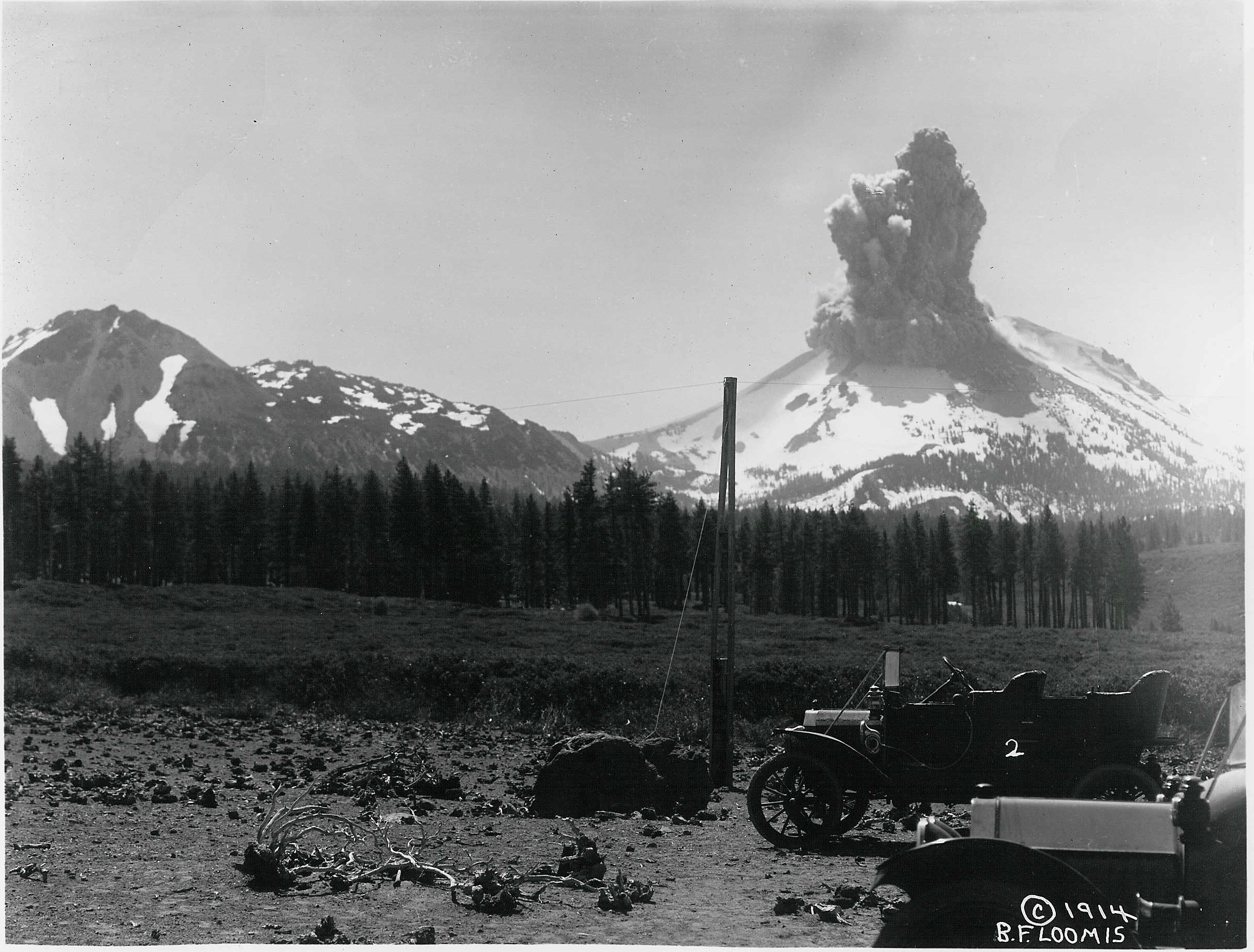
I first took a cave tour (of Sentinel, named because one column of rock looks like a face standing guard). Turns out, the guide was one of the guys I’d met at Crater Lake, so I got to ride in a US Government van to the cave (only 2 miles, but still what luxury!). There was also another intern at the park who was kibitzing the tour, which turned out to be informative. All the caves in the park are lava tubes, which form as lava rivers progressively overflow and harden on the upper edges, eventually completely filling up. The source of this lava is a nearby shield volcano, Mammoth Peak. Unlike other volcanoes (like that at Crater Lake, for instance), shield volcanoes don’t explode; they act more like a lava geyser, just throwing out bits of lava for a long period of time. This is what causes the flows that eventually become caves. Once the flow stops, the tube is left empty. At Lava Beds, there are 778 known caves; about 20 are open for exploration. The most recent lave flow was just 900 years ago.

The guide gave myself and the other intern a special tour on the way back, showing where it would be cool to do independent explorations. When I looked in one of the side-tubes, I saw a surprise: a bushy-tailed packrat. I’d never seen wildlife in caves before, but during my explorations I saw the packrat, a sleeping bat, cave crickets, and tiny millipedes. Maybe not the most exciting animals, but they’re an unusual sight underground. Aboveground, at night in my campsite, I caught site of a Kangaroo Rat, a funny hopping little rodent.


Cave gear: improvised helmet, heavy boots, kneepads

After the tour I explored a few caves myself. These caves and their features have evocative names: Hercules Leg, Cleopatra’s Grave, Catacombs, The Pool Room, Elephant’s Rump, Blue Grotto. By this point I’d invested in the necessary gear: a helmet, kneepads, and a guidebook. With the helmet – just a very simple construction helmet – I improvised a headlamp with duct tape. I explored several caves like this in the evening, parking outside the paved loop, which would be locked at 6:30: Hercules Leg/Juniper, Sunshine, Hopkins’ Chocolate, Devil’s Homestead.

In one cave, I met a squirrel – the squirrels here all look dusty – right at the edge of total darkness. The light of day was like a match held 100 feet away, and the squirrel appeared bewildered by my light. I stood quietly and it moved back and forth, then padded silently towards me. I’ve never seen such a docile squirrel; I even wondered if it had rabies (but it wasn’t aggressive). It walked silently past me, not a foot away, and then headed back to the entrance.


Lavacicles: tiny daggers hanging from the ceiling.

It’s a totally new feeling, being in these caves alone. At first it’s nerve-wracking: you’re not used to the total silence, and the sunlight means your eyes need time to adjust. When you enter the cave your headlamp seems impossibly dim after the brightness of day. Then there’s the double- and triple-checking to make sure you have everything: compass, map, backup flashlight, backup batteries. You don’t want to end up like Tom Sawyer, stranded in the darkness. I didn’t carry my backpack or camera most of the time; the space was too tight.


A good representation of the view.

After your eyes adjust, you can begin to press forward, carefully. The headlamp illuminates just a small sliver of the darkness; the helmet is useful for a reason (“oh, I’ll just watch my head in low spots,” I thought naively at first). You can look at your feet – and you must, because in many places the floor is extremely rough “cauliflower aa” rock, a 3-inch deep mess of solid stone, very sharp. But while you watch your feet, the ceiling can descend outside your light. It’s no smooth ceiling. As the lava receded it left a thin coating, which dripped down before cooling to create ‘lavacicles,’ like little daggers that cover the entire ceiling. When crawling these can cause painful cuts in your back.


A 2 foot gap, with helmet for scale. The floor is smooth here.

Most of the caves are cool – 50 degrees or so (some even contain ice), and very humid, but between crawling, taking meticulous care to follow the map, inching along on your belly, and duckwalking, you can work up quite a sweat. This drips all over you, saturates the headband of the helmet, and your breath clouds the air in front of you with fog, further obscuring your vision.

The funny thing is that these caves probably dip no deeper than 40 feet below the surface, but the isolation is total. Turn out the headlamp and you’re in complete darkness and silence. Sometimes you hear sudden water drips, which can be startling and unexpected.


Where the sidewalk ends

The following morning I did an early 7 mile hike to see one of the lava flows. This looks very much like the lava that flows into the ocean in Hawaii, but it’s peculiar: the desert just ends and a single jagged monolith of burned rock begins. I climbed on it a little, and slipped, and it’s very, very sharp.


Jail in Tule Lake relocation center

After that I visited a neighboring park. This was very confusing to me, but apparently in this small town of Tule Lake, there are two parks: Lava Beds, and a unit of “WWII: Valor in the Pacific,” a 12-unit park scattered across the Pacific dedicated to World War II. In this case, the park was based around a Japanese relocation camp in the area, which housed up to 18 thousand people. The park itself was a curiosity: a tiny little phone-booth sized visitor center (sharing a building with a museum dedicated to the county fair!), and then a few distant sites surrounded by fence. The park was apparently only open by appointment and for a single tour each week, which is what I took. It was led by the other guy I’d met at Crater Lake, and I got to ride in a government van again.

It was quite interesting: you could see the foundations of one remaining bathhouse in this vast unit, and a jail with contemporary pencil graffiti scrawled on it (touching: “show me the way to go home”). The work camp was originally CCC (Civilian Conservation Corps), then was used by Japanese-Americans, and finally by German and Italian POWs. The POWS were treated better than the Japanese-Americans. In the jail they had a silk-screen with a rare photo of prisoners in the bunks. Apparently on one tour, a woman started crying – she had realized that a man standing in the photo was her father!

I got the sense that the park was slowly growing and had received some small grants for repairs, but it was still the most primitive I’d seen. I didn’t mind, though, I learned something new.


Bustling downtown Tule Lake

The visitor center was in Tule Lake, perhaps the most depressing small town I’ve seen. The main street broad as a football field, with no cars. Nothing moved, most buildings were shuttered. The sun overhead was oppressive. This town had been settled by veterans, but now had dwindled to 1,000 people. Where were these people… who knows?


Map of Catacombs cave, with the rough route I followed marked.

Back at Lava Beds, I went on my longest cave exploration: Catacomb, a network of two interconnected lava tubes that extended over 2000 feet (but with 6900 feet of passages!). To cover the bulk of the cave requires 3-4 hours. I only saw a part of it, but it was still impressive. There were sections where I had to inch forward, in a sort of undulating pushup manner, through passages 1.5 feet high. When I had gotten most of the way through, I was finally confronted with a 1 foot high passage. This wouldn’t have been bad, except for the lavacicles on the ceiling, and that the floor was covered in this sharp rock. I turned around.

On my last day I went for a quick tour of Sentinel, exploring some of the side passages I hadn’t seen on the guided tour, and then headed to Lassen Volcanic National Park. In total I estimate that I spent about 4-5 hours exploring underground, alone. It was an amazing experience, a true novelty. I’d highly recommend checking out Lava Beds National Monument.

Crater Lake

8/14/2013-8/15/2013


Crater Lake

Crater Lake is one of the ‘major’ national parks – similar to Yellowstone, Rainier, and Grand Teton, with the amount of visitors you’d expect. At the park, I saw more east-coast license plates than I had in all of Washington: 3x NY, NJ, Connecticut, Massachusetts. Maybe it was just a coincidence.

Crater Lake was an enormous mountain (Mount Mazama) until 7,000 years ago, when it blew up and the caldera filled with water. The lake that formed is the deepest in the US (1940 feet!), and has the clearest water in the world – 143 feet of visibility. It’s big, 20 miles around, but not that big. The rim itself is very steep, and the water can only be accessed from one location in the park; from below the rim it’s impossible to tell that there’s a lake, which is why it was discovered very late, by a gold prospector.

The park was crowded – particularly the camping areas – but not nearly as overrun as Rainier. The roads, however, were worse. Here I saw my first ‘negative shoulder’ roads, where the white shoulder line had been eaten away by erosion. I don’t begrudge the park service: there are serious budget cuts and one campground was even closed. The fundamental problem is that a lot of the topsoil in the park is sand. Imagine building a sand castle and letting it dry out, then building a road on top. As the sand crumbles, chunks of the road are taken with it. Make the walls of the sandcastle 200 feet high and you have some idea of driving along the rim here. The roads are closed in the winter, too, because there can be up to 20 feet of snow. They have big poles near the road so snowplow drivers can see where to plow.


The Union Peak trail winds through this

After arriving I secured a site ($29, because I had to get an RV site!) and went on a hike. 11 miles, up to a nearby mountain, Union Peak. This hike also featured about 4 miles of hiking along the Pacific Crest Trail. It was moderate, and I enjoyed looking around and comparing the plants with those 100 miles away near the coast. The final mile of trail before the peak, however, turned into the most frightening hike I’ve been on so far: steep rocky scrambling and the ground was loose sand that frequently gave way under my feet. Parts were actually all a large gravel which, geologically, is known as talus.


On top of Union Peak; smog is obscuring most of the Crater Lake rim

I discovered the peak was already occupied by an older guy from Alaska for a while. He looked like a born runner and he’d hiked 1,000 miles on the Pacific Crest Trail… before having to give up because his hips couldn’t take the weight of the pack. Now he was mostly doing day hikes along the trail. I didn’t realize how old he was until he mentioned that he’d last visited Yosemite in 1972! He gave me some recommendations about parks I should visit, before heading back down. I visited the park at the same time that PCT hikers were passing through, and I always saw them congregating near the post office, eagerly digging through their resupply packs and availing themselves of the showers.


Looking down the trail at a switchback (several subsequent switchbacks are visible below). The start of the climb is visible in the upper right.

The view from Union Peak would have been good, except there was intense smog. Apparently local forest fires (about 100 miles away) were filling the air with this smog, and it seriously impinged on visibility. Additionally, I had trouble even picking out Crater Lake among the other mountains, as the water was not visible from the summit’s angle.


The famous ‘phantom ship’ rock formation in the lake

In the evening I had dinner and was invited to have s’mores with my neighbors. Although I declined the s’mores (they have gelatin, produced from pork), I sat by their campfire. There were two women from Portland, and one of them had two sons, about 10 years old. They were large people, to put it politely – I think the boys weighed as much as I did – and I discovered that they were planning on biking around the rim of the crater – about 20 miles through some very intense hills. I kept my doubts about the feasibility of the exercise to myself. The boys, meanwhile, farted on each other and tried to hit each other with firewood. One of them spoke in hashtags, saying for instance “Hashtag can’t stop, won’t stop.” It was as obnoxious as people spelling out “LOL.”

There’s a lot of bikers in the National Parks, and frankly the biking that they do feels like a form of insanity. I don’t mean because of the extensive hills. Rather, people drive quite fast on these roads with no shoulders, and biking on some of these roads seems really dangerous. One of the rangers at Crater Lake said there were 2-3 bike ‘incidents’ per month. I don’t know how severe that is, but I guess it’s less than I expected. Still, I’ll stick with hiking.


Saddle at the top of Mt Scott

The next day I decided to try a few more of the hikes recommended by a park ranger. I broke camp early and was the first person of the day to climb Mt Scott, the highest point in the park at 7900 feet. This was a rather dull trail, filled with switchbacks, but topped with a great panoramic view of the lake. It was 5 miles with 1000 feet of elevation gain; when I reached the top it was chilly in the morning air. Next, I went on a 13 mile hike along a combination of spur trails, the Pacific Crest Trail, and the Crater Lake ‘Discovery Trail.’


View of the lake from Mt Scott; the van is circled

The PCT here was a flat, easy hike, but the trail went through miles of land that had been hit with forest fires. What’s unexpected about fires is that they leave residue for decades, charred wood still visible, and although many trees are killed by the fire, they remain standing as their bark peels away and the wood bleaches in the sun. It was eerie walking through miles of this, with no living trees in sight. It also made for slow hiking, as this part of the trail was covered – the dead trees got knocked over the trail by winter storms.


Forest fire residue: miles of standing dead trees

After I reached a spur trail that looped back towards my starting point, I ran into a group of 5 rangers clearing the trail. They weren’t using chainsaws, just axes and handsaws, which was a shock to me. It must have been tough work. They also didn’t seem aware of the state of the PCT; when they asked me how it was, I could tell they weren’t excited about clearing another 2 miles of trail (I didn’t say this, but I thought this section of the PCT was the worst-maintained trail I’d seen so far, long due for a clean-up).


There’s a volcano in the volcano – Wizard Island. The water is exactly the same shade of blue as real life.

This wasn’t a very exciting hike, for 10 miles, and long hikes for a few consecutive days, along with a 4 mile uphill slog, wore me down. The final stretch of trail was great, though – 2.4 miles right along the rim of the lake. At last, the smog had cleared up and I had real view of the water, which was jaw-dropping. I’d heard the lake described as “really blue,” and it was – it almost hurt to look at. I’ve never seen a shade of blue that deep and intense in nature before. There were numerous overlooks along this segment of trail which were invisible to the cars below, and it was basically empty – so it was a real treat. Altogether I covered 18 miles with a lot of climbing; this was the second toughest day of hiking for me after my 20-miler in Mt Rainier.

Down the Oregon Coast on Highway 101

8/12/2013-8/14/2013


The stunning Oregon Coast

Before I started my trip, I’d heard good things about the Oregon Coast, and I’m happy to report that it lived up to expectations. I wasn’t sure what to expect, but it turns out there’s a lot of diversity. I started in the evening, after fleeing the traffic of Portland. The coast isn’t that far away, and my introduction was the town of Astoria – a pleasant small town, reminiscent of Port Townsend, but on the Columbia River, across the border from Washington. The Columbia here is broad, about the width of the Mississippi in southern Minnesota. For whatever reason, the traffic was insane (at 3:30 on a Monday). I don’t know if it’s normally that way, or if there had been an accident, but it was the worst traffic jam I’d seen so far in the trip – about 2 miles that took 45 minutes to travel.


Pretty much all of Fort Clatsop

My goal for the day was Fort Clatsop, which is another small National Historic Site. In this case, it was built once Lewis & Clark reached the Pacific Coast to serve as winter quarters before they headed back. The fort itself is miniscule, almost comically small, but the site has a decent museum and a good movie, and there were a reasonable amount of hiking trails: I did the “Slough to Sea” trail and then a trail to Nehul Landing, which is a former logging site near the coast. There were rows of old pilings there, and Oregon mountains in the background, but what stood out most was the blackberries – there were tons of them, all ripe for the picking. I must have eaten at least a pint, maybe two. Collectively I was able to log somewhat under 10 miles in this park.

I spent the night at Safeway in the town of Seaside – awakened for a while as a street sweeper made its way around the parking lot, and then followed up with a leaf blower cleaning out the cart areas. They were very thorough, but the lodging was free so I can’t complain.


The beach in early morning

I got up early and headed down the coast. Having seen little of interest during my half hour on the coast the previous day, I was stunned by how beautiful it was after I started driving. There’s a huge volume of campgrounds, picnic areas, scenic pullouts, boat launches sprinkled along the coast. On average, probably every 5 miles there was a beach to visit or state park. I picked a random one early on, as the sun was rising, to see what all the fuss was about.


These starfish were enormous, probably a foot across

This beach really took me aback. Compared to the Washington beaches, which are a little sand, or all rocks, and NY beaches, which are just sand, this was incredible. There were seastacks in the water, as you might see at the famous Rialto beach in Washington. The beach itself was very flat, and stretched out forever at low tide. Cliffs rose nearby, some with little waterfalls flowing down. There were tidepools – the first tidepools I’ve seen recently that showed any sign of life. Mussels and barnacles I’d seen plenty of elsewhere, but there were also huge starfish, little roly-polys, brine shrimp, and small fish.


‘Island’ of trees. Who wouldn’t want to climb that?

I continued on down the coast for a few hours before picking out another park. This one featured a large ‘island’ of rocks and trees above the beach, which I knew I had to climb. The beach itself was also nice, but not as good as the one I’d seen earlier.


View from a secluded section of the ‘island’

The trees were growing on a rock formation maybe 150-200 yards across and 50 yards deep; it was 150 feet high. Thee were a variety of trails leading into the undergrowth, many of them treacherous, a very steep grade with loose soil. Much of the climb was a ‘scramble’ – requiring handholds – but it was a lot of fun, and the panorama on top was worth the effort. There was a maze of narrow trails there, many partially closed in with vines and brush, and they opened up near the edge of the island for a view of the beach.


There are many overlooks along the highway with such views

I walked about 5 miles around these beaches before continuing on. My objective, which I reached around 1 pm, was a campground in the Siuslaw National Forest (perhaps the best National Forest I’ve seen so far on my trip). The location was called Cape Perpetua and was supposed to feature the best coastal view in Oregon. It was a well-run campground situated next to a small stream in a valley between two coastal mountains, with spotless bathrooms and great trails – the climb for the Mt Perpetua view was 830 feet of switchbacks in the forest; there was a WWII spotting station at the top. You could see the waves crashing against rocks below; when I visited them later they were covered with tidepools a constellation of tidepools.


The top of Mt Perpetua; the visitor center and coast trails are below

I also hiked to the local ‘Giant Spruce,’ which featured two stoners with a didgeridoo (conveniently left off the trail guide…), and then down to the ocean, covering an additional 10 miles on the day. That night I had my third campfire of the trip; this felt a lot more like a campground than some of the others I’d visited.

In the morning I continued down the coast before crossing inland to Crater Lake. The roads here, in southwest Oregon, by the way, were a delight – highways with nice shoulders, reasonable drivers, good scenery, and just the right amount of turns to keep things interesting without being obnoxious. Between the two local National Forests – Umpqua and Siuslaw – and the myriad State Parks, I can definitely see myself returning to this area.